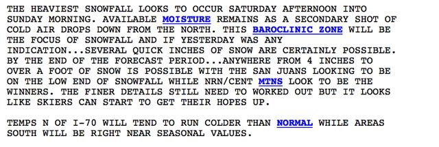
A Nov. 11 National Weather Service forecast from the Grand Junction office speaks to skiers
After a mellow start, November weather has shifted gears, with winter-like temperatures and the potential for regular snowfall during through the middle of the month. The Arctic air mass that rolled south from Canada stayed just east of Summit County and Copper Mountain, but also delivered a quick shot of snow, with a couple of inches on the valley floors and up to half a foot on the peaks.
Cold temperatures, perfect for snowmaking, should persist for the foreseeable future, with surges of Arctic air bringing chances for more snow mid-week and again next weekend. Be prepared for midwinter conditions, with forecast highs only reaching into the teens at mountain elevations this weekend. Look for daytime highs in the 20s the next few days, dipping downward on the weekend as more cold air arrives. Overnight lows should drop into the teens and even single digits in the chilliest spots.
Breckenridge is also set to open Friday, Nov. 14, so all four of Summit County's ski areas will be operating, albeit with limited terrain. Snowpack for the season to date is less than 50 percent of average across most of the Rockies, so terrain will be limited to areas with snowmaking for now.
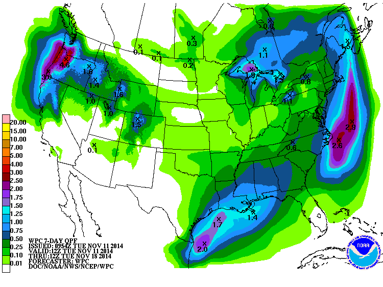
But the new snow did help Arapahoe Basin open the top of the mountain. The ski area fired up Lenawee Chair at noon Tuesday (Nov. 11), after reporting four inches of new snow. The National Weather Service map below shows the projected precipitation, in inches, for the next 7 days.
Filed in Colorado News | Copper Mountain News | Weather